Trails of Discovery in Murrindindi: Waterfalls, Paw-friendly Adventures, and Local Brews

Just over an hour northeast of Melbourne, Murrindindi Shire (or Dindi to the locals) feels like another world. This is a place where the Great Dividing Range rolls into misty valleys, where waterfalls thunder into fern-lined gullies, and where villages still echo with country hospitality.

It’s Victoria at its most raw and welcoming; a destination that rewards those willing to slow down and explore.

Three curated trails—the Wondrous Waterfalls Trail, the Furry Friends Trail, and the Pub & Tipple Trail—offer the perfect way to sample Murrindindi’s many personalities. Whether you crave nature’s drama, family-friendly encounters, or a well-earned drink with character, these itineraries invite you to linger, taste, and discover.

The Wondrous Waterfalls Trail: Nature’s Theatrics

Steavenson Falls

Waterfalls have a way of pulling us in. They mesmerise with their rhythm, inspire with their force, and soothe with their spray. The  Wondrous Waterfalls Trail strings together some of the Murrindindi region’s most dramatic cascades, each one set in its own lush amphitheatre.

Start with Steavenson Falls, Marysville’s crown jewel and one of Victoria’s highest waterfalls at 84 metres. A short, accessible walk takes you to a base lookout where the sheer drop crashes into the pool below, but those with energy to spare can climb to the top and feel the forest breathe around them. Visit at dusk and the falls glow under floodlights, an ethereal spectacle that lingers in the memory.

Next, seek out Keppel Falls, reached via a gentle forest track where the sound of rushing water builds anticipation. Here, the Taggerty River tumbles dramatically over rock ledges into a swirling basin. It’s wilder, less tamed than Steavenson, and perfect for those who prefer their nature rugged.

Heading North West, the Wilhelmina Falls in the Murrindindi Scenic Reserve might be the trail’s most thrilling stop. The cascading rock face stretches more than 75 metres, and from the viewing platform you can watch sheets of water fan across granite in silver ribbons. The hike here is a little more demanding, but the payoff of  an expansive view of both the falls and the surrounding ranges is worth every step.

Round out your journey with Snobs Creek Falls, near Eildon. Accessible by a short walk, these falls thunder into a narrow gorge, sending spray high into the air. It’s raw power on display, a reminder of the forces that shaped this land.

Together, these waterfalls are more than stops on a map. They’re chapters in a story about resilience, recovery (many forest areas regrew after the Black Saturday fires), and the endless cycles of water that nourish the Murrindindi valleys. Summer and spring bring them alive, fed by snowmelt and seasonal rains, the ideal seasons to feel their full force.


The Furry Friends Trail: Adventures With Your Four-Legged Companion

Murrindindi dog walks

For many of us, a holiday doesn’t feel complete unless the dog comes too. Dindi welcomes four-legged travellers with open arms, offering trails, parks, and pet-friendly stays where wagging tails are part of the landscape. The Furry Friends Trail is your guide to making memories alongside your canine companion.

Start with the great outdoors. The Murrindindi Scenic Reserve has plenty of open space and walking tracks where dogs are welcome on lead, letting you and your pup share the joy of cool gullies, towering gums, and fresh country air. Similarly, the Rail Trails near Yea and Alexandra are ideal for a longer wander; easy gradients, shaded stretches, and historic markers to sniff out along the way.

When it’s time for a break, you’ll find cafés and pubs across the region with dog-friendly courtyards. In Yea, grab a coffee and sit outside while your pup snoozes under the table. In Marysville, enjoy a post-walk lunch in a leafy beer garden where water bowls are as much a fixture as bar stools. Many venues along the Pub & Tipple Trail (below) overlap beautifully with this one, meaning you won’t have to choose between good company and good food.

Accommodation is also part of the story. Murrindindi’s cottages, cabins, and campgrounds often cater for pets, whether it’s a cosy fireplace retreat where your dog curls up at your feet or a riverside campsite where they can explore the scents of the bush. Booking ahead ensures you’ll find the perfect fit, but you’ll be pleasantly surprised by how many operators in the shire extend hospitality to animals as warmly as they do to humans.

The Furry Friends Trail is more than a convenience, it’s a celebration of how travel changes when shared with a loyal companion. With dog-friendly tracks, stays, and dining dotted across the region, Dindi makes it easy to pack the lead, clip on the harness, and hit the road together.


The Pub & Tipple Trail: A Toast to Country Hospitality

Bonfire Station Brewery

After waterfalls and meandering dog trials, what better way to round out a day than with a hearty meal or a local pour? The Pub & Tipple Trail is a celebration of Dindi’s hospitality scene; pubs steeped in history, craft brewers and distillers, and cellar doors pouring with pride.

Start in Yea, where the historic Yea Peppercorn Hotel welcomes travellers with stone walls, timber beams, and a menu that nods to both tradition and creativity. Think local lamb roasts, slow-cooked beef, or just a cold beer on the verandah as the sun sets over the main street.

In Alexandra, the trail leads you to pubs that have served gold miners, timber workers, and generations of locals. The Alexandra Hotel, with its warm atmosphere, often hosts live music and boasts a wine list rich with nearby Yarra Valley and Upper Goulburn vintages.

Beer lovers will find satisfaction at microbreweries tucked into valleys, where brewers experiment with hops and barley grown not far from the taps. Pair a pale ale with a plate of regional cheeses and you’ll taste the landscape in liquid form.

For something stronger, distilleries are carving out a niche in Murrindindi, producing gins infused with native botanicals and whiskies that carry the character of mountain air. Tastings often come with stories: about the water source, the botanicals foraged, or the history of the building itself.

While Murrindindi sits on the edge of more famous wine regions, its cool-climate vineyards produce elegant pinots and crisp chardonnays that pair beautifully with the local produce on pub menus.

The Pub & Tipple Trail isn’t just about what’s in the glass, it’s about atmosphere. It’s sitting beside a wood fire after a day on the trails, swapping stories with strangers who don’t stay strangers for long. It’s a reminder that travel is as much about people as it is about place.


Pack Your Curiosity and Go

Marysville shopping

In an era when travel often means ticking boxes, Murrindindi encourages something slower. These three trails—waterfalls, furry friends, and pubs—aren’t checklists but invitations. They invite you to pause before a thundering cascade, to kneel in the grass beside a curious alpaca, to raise a glass in a pub that’s been the town’s heart for generations.

Only an hour or so from Melbourne, yet a world away, Murrindindi is a reminder that the richest journeys are often the closest to home. This spring and summer, follow a trail—and let it lead you to discovery.

From rolling green hills to charming railway towns: your guide to West Gippsland

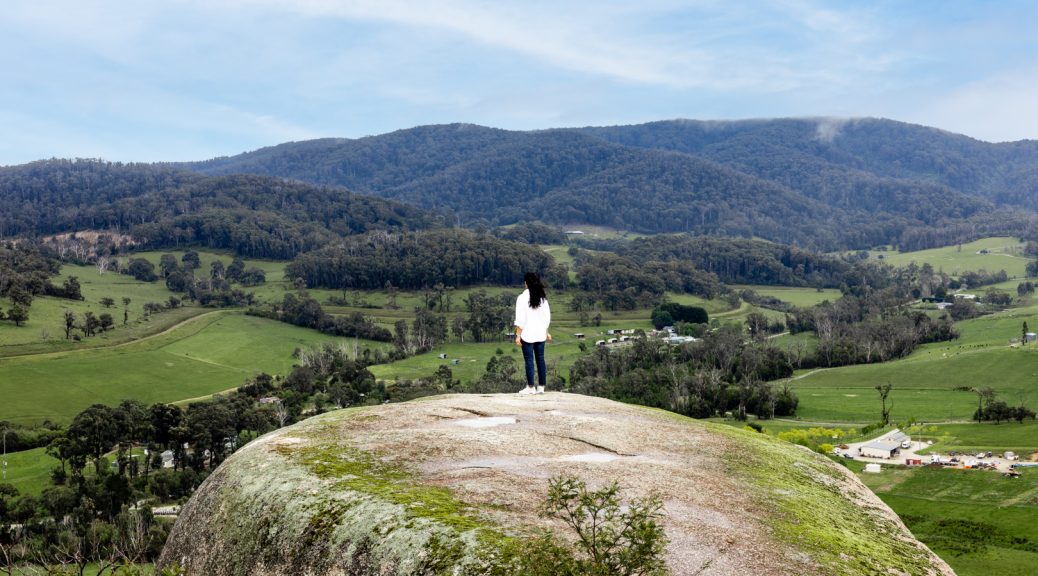
Many times we have watched with envy, the photos uploaded by those touring the region of West Gippsland. So we thought it’s about time we explore this region for ourselves. 

The rail towns of West Gippsland are less than an hours drive from Melbourne CBD and with the option of catching a V-line train, means you can easily explore this diverse small-town community as a weekend day trip with friends.

As you can see from our itinerary below, it’s quite the day out, with not a moment to spare, so pack the car or jump on the V-line and come and join us in West Gippsland!

Highlights of the
Diamond Creek Trail

Winding its way between Eltham and Hurstbridge, the Diamond Creek Trail is popular with bike riders, joggers and walkers of all ages, who come to explore the wonderful mix of playgrounds, wetlands, historic sites and cafes that make the trail so endlessly fascinating.

The trail is approximately 20 km in length with the northern end of the trail starting just near the Hurstbridge railway station. The trail mostly follows the flow of the Diamond Creek, diverting at times past the railway, bushland reserves and football ovals to end at Eltham Lower Park, just a 30min drive or train ride from the Melbourne CBD. 

There’s so much to see and do along the Diamond Creek Trail, so use our guide to plan your own trip along this wonderful treasure in the north east of Melbourne.


Top Trails: Six ‘Must Explore’ Walks on the Murray

Words by Gwen O'Toole
Images supplied

Nature enthusiasts and adventurers take note, these walking trails are sensationally scenic. Lace up your comfiest hiking boots, grab your water bottle and explore some of the best walks along Australia’s longest river.

Kings Billabong Nature Trail – Mildura

Kings Billabong Nature Trail- Mildura
© Parks Vic

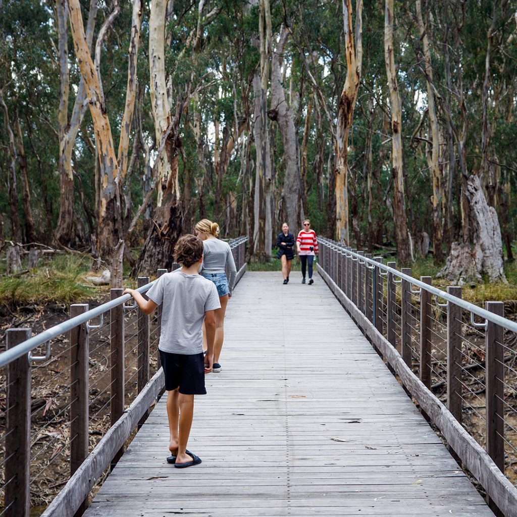
An excellent option for those looking for an easier walking trail, this 9.2 km return trail is popular among walkers, cyclists and bird enthusiasts, it wanders through the river red gums to the historic water pumps at Psyche Bend. Used for moving water from the Murray River to Kings Billabong, it became a vital irrigation system for Mildura’s wine and fruit-growing region in the late 1800s.

Along the way, stop at Bag Bridge for a picnic or a rest to fully enjoy the surroundings, keeping a keen eye out for waterbirds such as ducks, spoonbills and kingfishers.

How to find it: Turn right off Irymple Avenue in Mildura at the Kings Billabong Park sign. Follow the Parks Victoria signs to the walk.

Discover more.

Barmah Lakes Loop Track – Echuca

Barmah Lakes Loop Track – Echuca
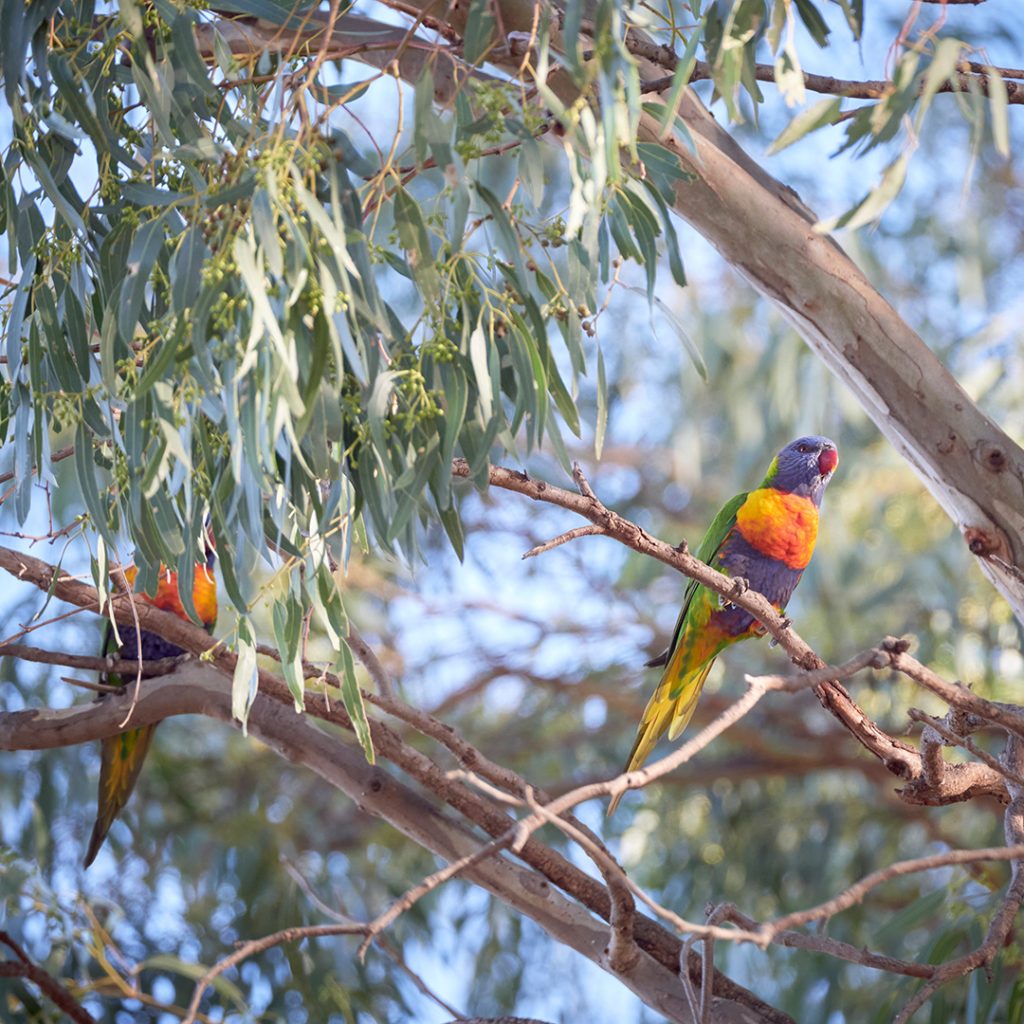
The Barmah National Park and Murray Valley National Park combine to create the largest red gum forest in the world. The 4km circular walking track takes just shy of two hours to complete as you wander through the towering red gums passed cooking mounds of the Indigenous Yorta Yorta people, Barmah Lake, the Murray River and Broken Creek.

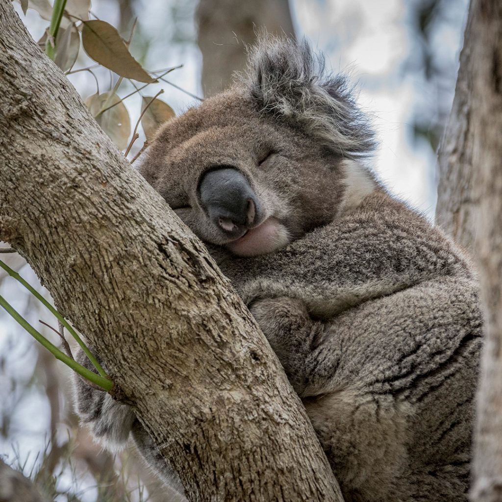
Camping areas are available along the Murray River portion of the Park and it’s not uncommon to spot native eastern grey kangaroos, koalas and hundreds of bird species along the walk.  

How to find it: This loop track begins and ends at the Dharnya Centre. While the Centre itself is currently closed, the track as well as other walks in the region are open for exploring.

More here.

Pink Lakes Trail – Murray-Sunset National Park

Pink lakes trail - Murray-Sunset National Park
© Parks Vic

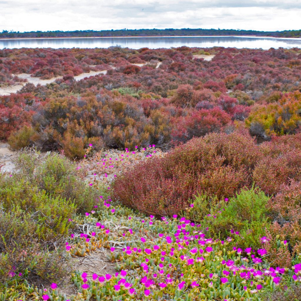
These super salty, Insty-famous pink lakes are at their best bubble-gum hue on a sunny day, just following a big rain between 10 am and 2 pm. The Pink Lakes Trail is an intermediate-level hike just a tad over 4 km long.

Along this historic trail, keep an eye out for relics of the historic railway used to haul crystal salt from the shore including a former skip frame from the Sailor Salt Co. You’ll also spot cordwood slipways created from the lake shore to make salt extraction easier. Lake Becking offers a basic free camping site where you relax beside this blushing beauty and watch how the colour changes throughout the day.

How to find it: You can spot this rosy wonder all the Mallee Highway, in northwest Victoria, roughly 60km west of Ouyen. The trail is best accessed from the nearby Lake Becking camping area.

Take a look here.

Goanna Walking Track – Koondrook

Goanna Walking Track – Koondrook Gunbower Island
© OHO Media

As part of the Gunbower State Forrest, this easy-to-walk 3.2km looped track is set amid gorgeous wetlands and includes the Gunbower Creek Footbridge. Follow along and you’ll return to Koondrook via the historic Condidorio’s Bridge. Walking among the redgums along the creek, you might spot a kangaroo overlooking the bushland or the abundant birdlife that calls this reserve land home.  

If you’re keen to make an overnight of it, this track passes Koondrook Retreat where you stay in a creek-side safari-style glamping tent and wake to birdsong. Take the time to visit the Koondrook Waterfront and Wharf before you go home- it’s well worth the stop whether you’re a history buff or not, the views here are photo-worthy.

How to find it: Start at the footbridge near Koondrook Retreat or park just over the bridge on Gunbower Island at the start of the Red Gum Walking Tracks.

Find out more here.

Kinnairds Wetlands Walks – Numurkah

Kinnairds Wetlands
© Visit Swan Hill

Three walks weave their way through these luscious wetlands, offering a spectacular glimpse into the diverse range of native woodlands and birdlife and more. The best bit? All three can easily be done in a day.  The constructed trail walks are popular with cyclists and bushwalkers as they include easy terrain with boardwalks and picnic spots.

The Red Gum Walk Loop is 3.5 km and passes by towering red gums that are hundreds of years old. It also features some beautiful views around the entire wetland region.

The 2 km Wetland Walk Loop Trail takes you over a boardwalk for views over the eastern side of the wetlands. Bird enthusiasts, keep an eye out for the bird life. The shorter Young Red Gum Trail connects to the spillway boardwalk through the river red gum regeneration forest. Here the habitat change appeals to different bird and wildlife species. If you’re a bird person, you can grab both a map and a list of resident bird species from the visitor centre on Melville Street in Numurkah.

How to find it: From Kinnairds Road in Numurkah, the trails are accessible via Wattle Drive, Quinn Street and Naring Road.

Learn more.

Hume and Hovell Walking Track – Albury

Murray River Walks
© @humeandhovelltrack

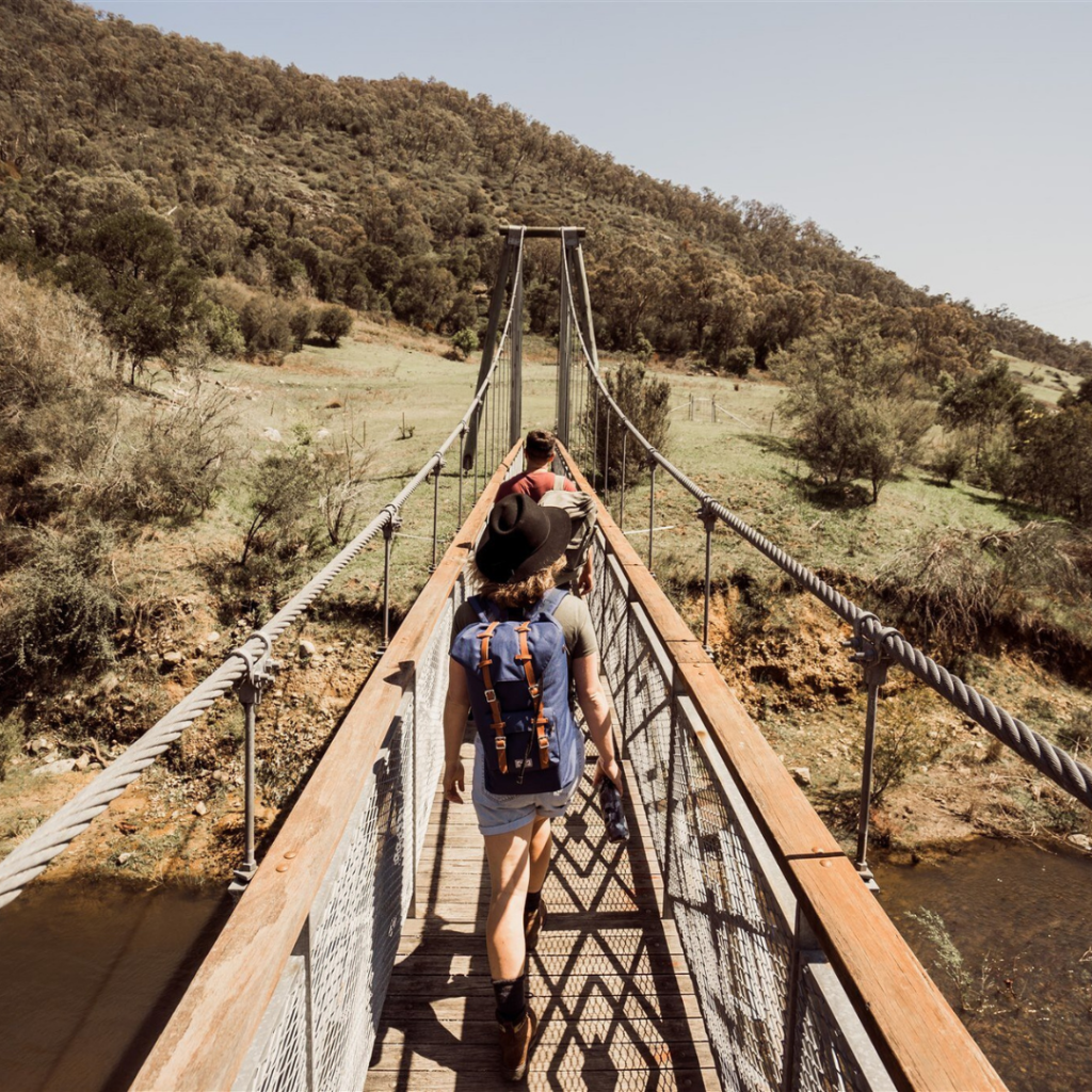
If long-distance hiking is calling your name, this 426km trail should be at the top of your list. Starting at Cooma Cottage in Yass, it closely follows the route taken by explorers Hamilton Hume and William Hovell in 1824-1825 as they sought new grazing land.

Taking anywhere from 18 to 26 days to complete, walkers can tackle this one bit by bit as a day hike (all the shorter walks are signposted), or do the whole track start to finish from Albury to Yass (or Yass to Albury).

With more than 100 footbridges along the way, you’ll pass through cool-climate forests, weaving along the river’s edge travelling by waterfalls, creeks, wetlands, several campsites and picnic spots as you go.  Portions of the trail are easy to stroll while others are more difficult. Grab a map or visit the trail website and make your plan.

How to find it: Depending on the trail you choose; you’ll begin at different starting points. Maps and guidebooks with packing lists, tips etc., can be found online or obtained from the Visitor Centre in Yass.  

Details here.


NOTE:
As with all outdoor adventures, it’s important to remember that mobile phone reception may not be available everywhere, so walk with a partner or two or let someone know where you’ll be, stay on the marked trails, take plenty of water with you and always leave the trails as beautiful as you found them (i.e., take any rubbish with you.) 

We wish to acknowledge the traditional owners of this land and to pay our respects to their Elders, past and present.